Met Office
|
|
Operational satellite a ‘landmark moment’ for weather forecasts
Meteosat’s Third Generation Imager (MTG-I1) satellite will now be referred to as Meteosat-12, marking a shift to its now operational use in weather forecasting.
Imagery from the new Meteosat-12 is officially becoming available to operational meteorologists, in what is the latest phase of a 20-year project to safeguard and improve weather forecasts across Europe for the next 20 years.
After launching in 2022, and having undergone a period of calibration and testing, Meteosat-12 is now set to provide a more detailed and more frequent view of Europe’s weather systems, helping meteorologists in various applications, ranging from forecasting impactful short-term weather events to long-term climate monitoring.

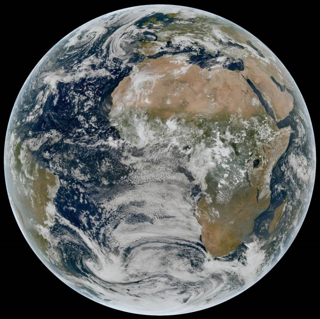
MTG Flexible Combined Imager True Colour image of the earth. Image: Ⓒ Crown Copyright, Met Office, Data: EUMETSAT
Positioned in a geostationary orbit 36,000km above the Earth and providing a view of Europe and Africa, Meteosat-12 hosts an advanced imaging instrument as well as the first ever lightning imager covering the region, vastly improving short-range ‘nowcasting’ of developing severe convective systems.
Full Earth disc satellite images will be available 33% more frequently (now every 10 minutes) compared to previous satellites, with imagery providing resolution of up to 500m on some channels, and between 1 and 2km on other channels.
Met Office Scientific Manager Thomas Blackmore, who has been working on the development of the project with colleagues from across Europe, recently said:
“This is a landmark moment for weather forecasts as these new generations of satellites often take decades to develop.”
“Now it’s providing operational imagery to meteorologists across Europe, Meteosat-12 will begin to demonstrate its importance. With more frequent and detailed imagery than existing satellites, meteorologists will be able to better assess impactful short-range weather events, including storms, strong winds and heavy rainfall.”
Quoted in the annoucement, EUMETSAT Director-General Phil Evans recently said:
“MTG is one of the most innovative and complex meteorological satellite systems ever built. We have been working with our member states’ meteorological services to ensure they can make the best use of the data, which is essential for one of the main challenges they face - the rapid detection and forecasting of severe weather so that citizenry, civil authorities and first responders receive timely warnings.
“When the full constellation of MTG is in place, it will be possible, for the first time, to observe the full lifecycle of a convective storm, from before clouds begin to form through to detection of lightning strikes.”
As well as the satellite providing more frequent and detailed imagery, Meteosat-12’s lightning imager represents a marked shift in the understanding of convective systems in Europe.
Tom Blackmore added:
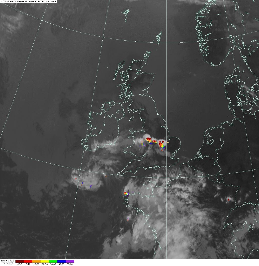
“This is the first time that lightning detection from space will be covering the region, which will enhance forecasts around severe convective systems. Previously, we relied on our ground-based network to understand the amount of lightning activity, but this top-down view will give us a lot more information on the strength and evolution of these systems, by being able to observe more cloud-to-cloud lightning strikes.”

MTG Flexible Combined Imager infrared image with Lightning Imager flashes overlaid. Image: Ⓒ Crown Copyright, Met Office, Data: EUMETSAT.
The next phase of the project will see observations from the satellite incorporated into weather prediction models on the supercomputer, helping to enhance the data used as part of routine weather forecasting and improving our simulations of future weather.
Further satellite launches are planned from EUMETSAT and ESA in the coming years to further enhance weather forecasts.
About this blog
This is the official blog of the Met Office news team, intended to provide journalists and bloggers with the latest weather, climate science and business news, and information from the Met Office.
Original article link: https://www.metoffice.gov.uk/blog/2024/operational-satellite-a-landmark-moment-for-weather-forecasts


.jpg)