

GeoPlace
|
|
You asked, we delivered!
We are pleased to announce the rollout of new developments to FindMyStreet!
FindMyStreet is the powerful online tool that provides comprehensive information on all the streets recorded in the National Street Gazetteer for England and Wales. Find street names, locations, see which are maintained at public expense, and determine if they are part of the classified road network! Experience a new level of convenience and precision in your street data searches!

Blog by Hazel Kamuriwo, Associate Product Manager at GeoPlace
To help us improve FindMyStreet we have received over 250 submissions giving us feedback of what to include next. We've listened to your requests and are delighted to unveil enhancements.
Our focus has been on improving the search functionality, map features, List of Streets, and Frequently Asked Questions (FAQs) sections. These upgrades are designed to improve the user experience, ensuring FindMyStreet is more user-friendly than ever. Thank you for helping us shape the future!
FindMyStreet 3.0
1. Search Function
a. Search by Postcode
With the latest update, users can now conveniently search for locations using postcodes. In addition to the search by Street Name or USRN, Postcode search provides an extra option to find desired locations quickly.
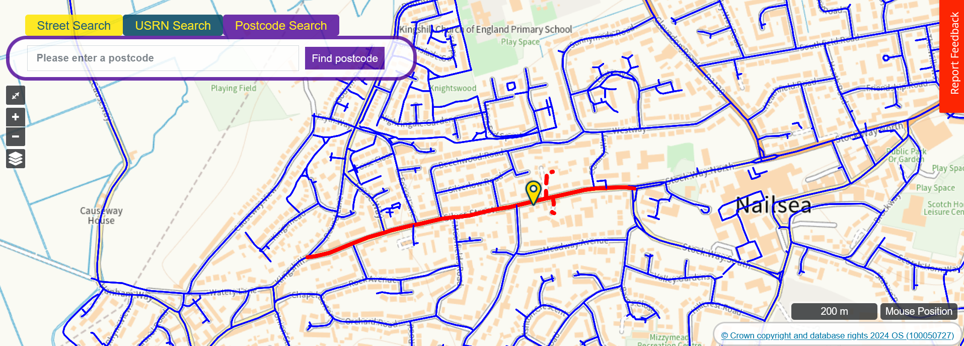
b. Prioritisation of Search Results
We have implemented advanced logic to prioritise search results based on relevance. This enhancement ensures that users receive the most pertinent information upfront.
2. Map Features
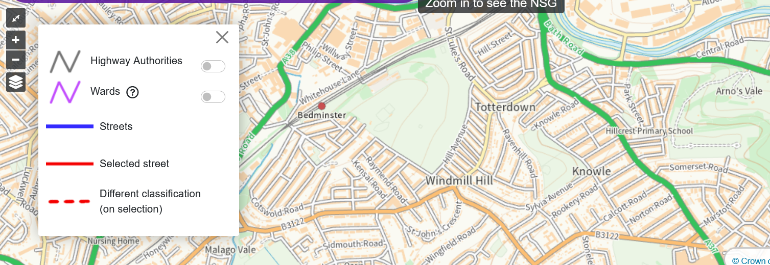
c. Addition of Highway Boundaries Layer
FindMyStreet now includes a highway boundaries layer, enriching the map interface with essential road network information. Users can toggle this layer on/off, enabling customisation of the map view according to preferences and needs.
d. Addition of Ward Boundaries Layer
An enhanced mapping experience with the additional ward boundaries! Viewable at a 5km zoom level. The toggle on/off capability empowers the tailoring of the map display, offering flexibility and clarity in navigation.
e. Enhancements to Map Key
We have revamped the map key to provide clearer guidance and understanding of the symbols, colours and other visual elements on the map. These improvements allow easy identification of layers.
f. Changes to Road Classification Text
Revisions to road classification text to reduce ambiguity and improve clarity. Where a Road Classification is neither M, A, B or C classification, text is now recorded as “Neither, M, A, B or Instead of the previously stated "None".
3. List of Streets
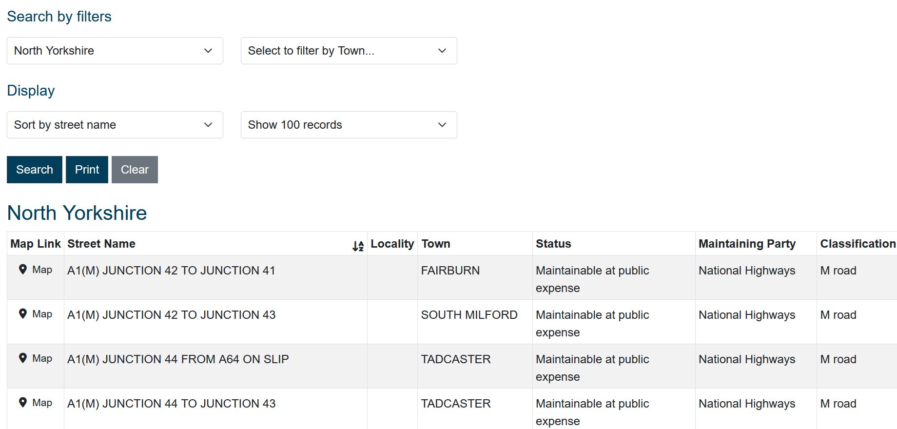
g. Classification Field Addition
The addition of a classification field enriches the street list, providing users with valuable insights into road attributes. This enhancement enhances the relevance and usability of the street information.
4. Content
h. New and Updated FAQs Information
We have expanded our FAQs section to address common user queries comprehensively. This resource serves as a valuable support tool, empowering users with relevant information and guidance.
5. Conclusion
FindMyStreet uses data held in the National Street Gazetteer (NSG), the definitive source of information about streets in England and Wales.
Original article link: https://www.geoplace.co.uk/blog/findmystreet-latest-release
| Home | About | Addressess | Streets | Helpdesk | News & Events | Exemplar | Consultancy |
